Jastrebarsko area map
canvas, see more
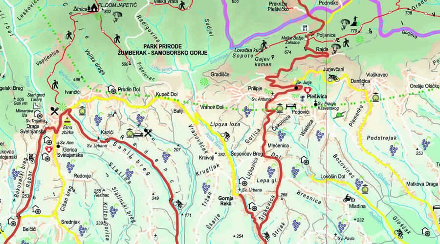
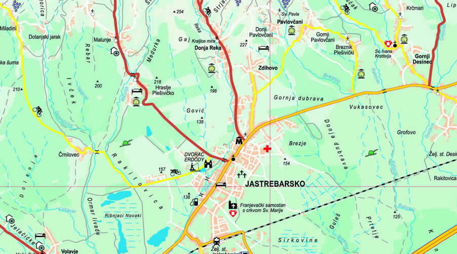

Detailed geographical and road map of Jastrebarsko and the surrounding area with tourist attractions and locations within easy reach.
The map of tourist attractions of Jastrebarsko shows the surroundings of the city. Seven kilometers away from Jastrebarsko, Plešivica rises high along the mountain ridge of the same name (779 m) from which a view full of diversity and beauty is offered. Japetić, the highest peak of Plešivica (879 meters), has been declared a forest vegetation reserve due to its preserved natural beauty.
The most valuable natural heritage of Jastrebarsko and the surrounding area is certainly the ornithological reserve Crna Mlaka. It is located in the central part of the swamp-forest area, 11 kilometers southeast of the town of Jastrebarsko. Detailed map of Jastrebarsko with the best places to visit and tourist attractions (villages, Plešivica peaks, archaeological sites, and other places for a pleasant walk).
In both business and personal life, I've always found that travel inspires me more than anything else I do. Evidence of the languages, cultures, scenery, food, and design sensibilities that I discover all over the world can be found in every piece of my jewelry.
You define a good flight by negatives: you didn't get hijacked, you didn't crash, you didn't throw up, you weren't late, you weren't nauseated by the food. So you are grateful.