Europe - postal codes map
canvas, see more
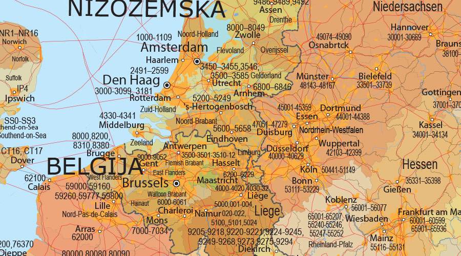
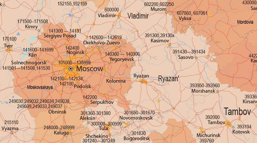

The map shows first-level administrative divisions with postal codes. Almost every country in the world has administrative divisions, which have different levels. For instance a country may be divided into states or provinces, then further subdivided into counties or municipalities. Perfect for business professionals expanding into new markets, investors analyzing regional opportunities, logistics companies planning distribution networks.
Wall maps in the office serve multiple business functions, improving operational efficiency and professional presentations. They are used by companies that offer services in specific locations to help staff map customer addresses and send information to field workers. Postal code maps can help you visualize relevant data from a map and gain insight into your complex data sets. Spreadsheets can be fickle. We all have them, we all know how to use them, and data visualization is much easier on a wall map.
Never cut a tree down in the wintertime. Never make a negative decision in the low time. Never make your most important decisions when you are in your worst moods. Wait. Be patient. The storm will pass. The spring will come.
There is something good in all seeming failures. You are not to see that now. Time will reveal it. Be patient.