Road and tourist map of Hrvatsko Zagorje
canvas, see more
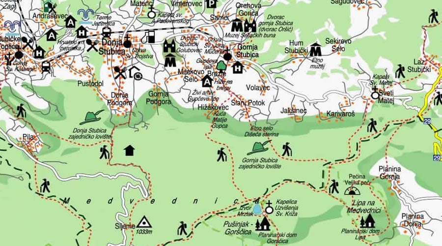
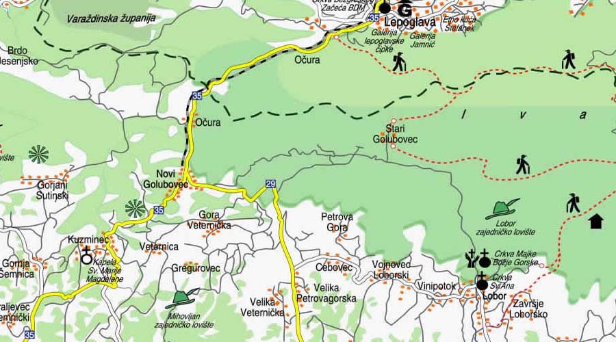

Tourist attractions in Croatia on the map of Hrvatsko Zagorje. Detailed map with the best places to visit and tourist attractions cycling routes, walking trails.
Hrvatsko Zagorje is a cultural and historical Croatian region and a separate natural and geographical entity in the northwestern part of Croatia. It is separated from Zagreb by the Medvednica River, hence its name - "behind the mountain". It is a predominantly hilly area between Medvednica, Kalnik, the Drava, Sutla and Sava rivers, the central part of which, in a west-east direction, is the Maceljska gora - Strahinjščica - Ivanščica - Varaždinsko-topličko gorje mountain range, which divides Zagorje into two parts - north and south.
Perhaps travel cannot prevent bigotry, but by demonstrating that all peoples cry, laugh, eat, worry, and die, it can introduce the idea that if we try and understand each other, we may even become friends.
A man who leaves home to mend himself and others is a philosopher; but he who goes from country to country, guided by the blind impulse of curiosity, is a vagabond.